
 The aspects of optimizing route parameters and creating a supply chain using artificial intelligence have been presented in our blog posts recently. In one of our recent posts, we presented how AI route optimization may be used not only for the logistics industry but also for pharmacy medicine transport coordination for corporate pharmacy networks. Another application that we developed recently for one of our corporate clients is a support decision system for emergency actions aimed at improving the operational effectiveness of local rescue operations.
In this post, we described how we utilized DeliverM8 logistics optimization platform, as support of entities in emergency situations. We will briefly present how modern IT technologies such as mobile apps, push notifications and web applications can bring observable benefits and even improve security and effectiveness of operations, which is crucial in emergency situations.

Use Case
The use case described in this article is a system supporting local fire brigade teams in real-time navigation and communication during actions which is archived by providing team members with the current traffic, roadblock and general current situational awareness regarding the route availability and supporting real-time decisions in the scope of route selection.
The implemented system must meet the following requirements:
- enable entering the address of the incident,
- generate three alternative routes to the selected incident destination,
- inform the fire brigade via push notifications, text messages or other options…
- transmit the route seamlessly to a built-in navigation device (Android),
- display the route and the locations of emergency infrastructure (nearest hydrants, evacuation points etc) around the incident, allowing the selection of the target destination,
- navigation to the selected destination via the built-in navigation system.
To meet these requirements, we have built a three-layer architecture, where the database is located on a central server, and access to it is possible through the data management and processing module. Operating server provides functionalities available via REST API for a user interface dedicated for web browsers and mobile applications. The communication structure between the individual components is shown in the figure below.
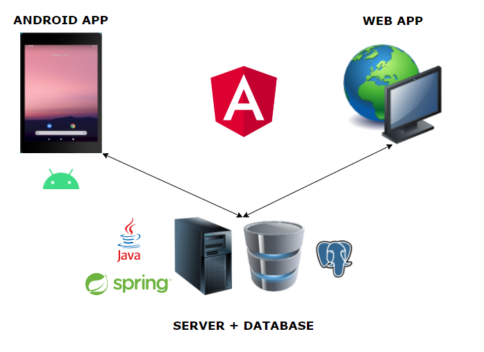
The target application was implemented using Java Spring with the PostgreSQL, while the web and Android application was provided by the Angular framework.
An example of using the system
One of the most important for the end-user to work with the proposed system is appropriate handling of real-time passability of chosen routes and passes. Therefore, we proposed a solution where our system communicates via dedicated interfaces with an internal infrastructure of our clients and verifies passability of the chosen route. In the case of road-block, the system is capable of choosing different routes that pass it to the navigation device seamlessly. Generating routes works on the basis of an iterative process and successive avoidance of waypoints, which in this case are railway crossings. Having the visualization and the necessary parameters, the user may choose the best alternative at a given moment.
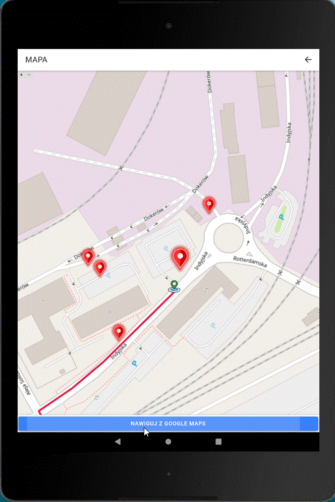
In order to illustrate how the system works, the generated solution is shown in the figure below.
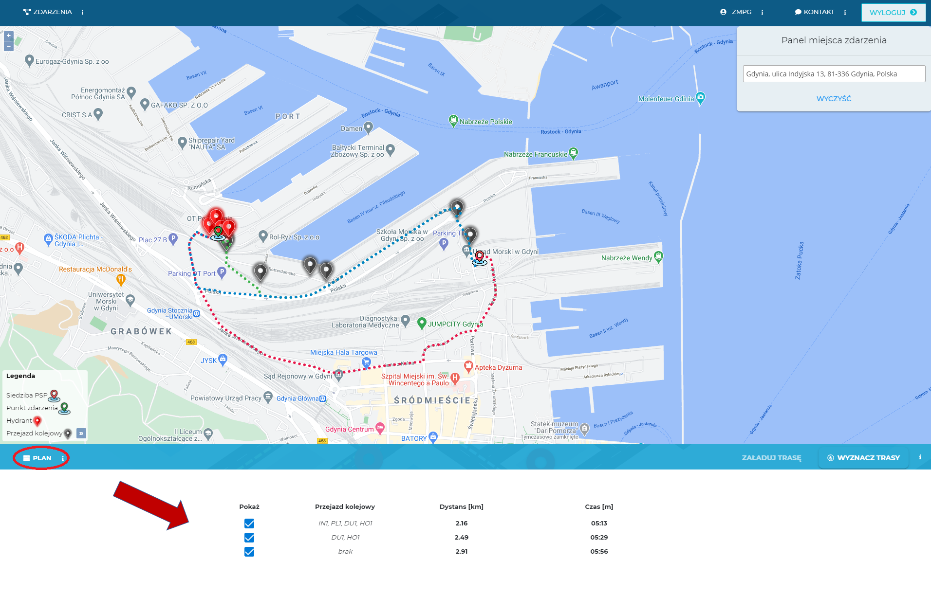
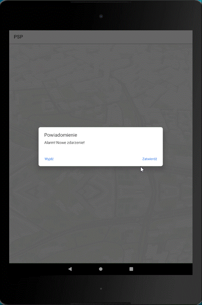
Additionally, by clicking on the “Plan” section as in the figure above, the user may analyze a route data such as railroad crossings, distance in kilometres and ETA (estimated time of arrival). The next step is to select the route by clicking on the map and uploading it to the navigation application for the emergency brigade. Thanks to this, the system informs a built-in navigation subsystem tablet about the event from the backend side, e.g. via a push or SMS notification.
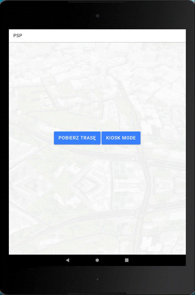
After approving this notification, the system displays a map component with the destination route and the information required to perform emergency action such as locations of hydrants in the vicinity of the event location. Clicking on the target allows the user to navigate via using built-in navigation functionality button. We showed it in GIF animations below.
Summary
In this short use-case blog, we presented how our logistic transport optimization platform helps to support real-time emergency actions performance. An example of using a fully connected system for a standard user takes about a minute from pointing a target to send navigation data to a mobile tablet. There is a significant time difference compared to the previous execution of all activities. In addition, the desired route is selected based on the decision block and the input information analyzed in real-time. Moreover, the system provides specialized tools tailored to the client’s needs., namely the archiving and reporting on previous incidents and their visualization and analysis in a dedicated responsive user interface.